High-Quality Cartographic Roads on High-Resolution DEMs
Mikael Vaaraniemi*, Marc Treib, Rüdiger Westermann
*BMW Forschung und Technik GmbH, München, Germany
Computer Graphics and Visualization Group, Technische Universität München, Germany
Background
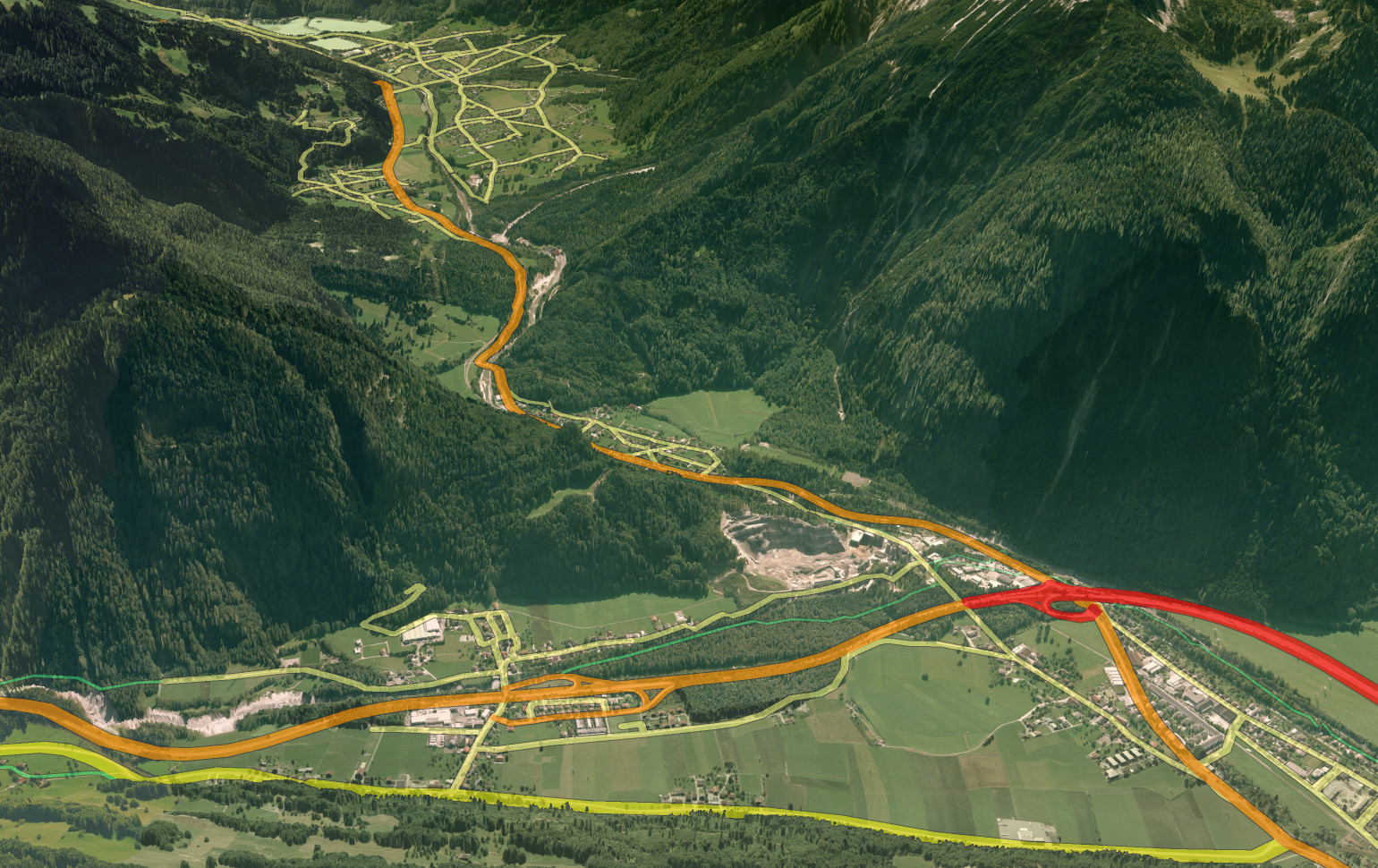
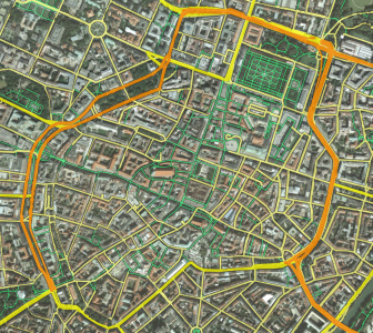
The efficient and high quality rendering of complex road networks-given as vector data-and high-resolution digital elevation models (DEMs) poses a significant problem in 3D geographic information systems. As in paper maps, a cartographic representation of roads with rounded caps and accentuated clearly distinguishable colors is desirable. On the other hand, advances in the technology of remote sensing have led to an explosion of the size and resolution of DEMs, making the integration of cartographic roads very challenging. In this work we investigate techniques for integrating such roads into a terrain renderer capable of handling high-resolution data sets. We evaluate the suitability of existing methods for draping vector data onto DEMs, and we adapt two methods for the rendering of cartographic roads by adding analytically computed rounded caps at the ends of road segments. We compare both approaches with respect to performance and quality, and we outline application areas in which either approach is preferable.
Acknowledgments
This publication is based on work supported by Award No. UK-C0020, made by King Abdullah University of Science and Technology (KAUST).
Associated publications
High-Quality Cartographic Roads on High-Resolution DEMs
M. Vaaraniemi, M. Treib, R. Westermann
Journal of WSCG 19(2):41-48, 2011
[PDF] [Bibtex]