GPU-Friendly High Quality Terain Rendering
Background
Latest advances in scanning technologie, such as the HRSC of the DLR, make the faithful acquisition of large-scale terrain at ever finer resolutions possible. However, with raster data approaching and even surpassing a resolution of several samples per meter, the sheer amount of the data collected becomes a problem. As a result there is a dire need for software solutions that can effectively deal with data sets that are several dozens or hundreds of gigabytes in size. Such systems would be ideally capable of displaying flights over the digital representation of the terrain at interactive rates, while maintaining high image quality.
The advantages of providing high image quality are manifold. Firstly it enables the user to perform accurate measurements in the virtual terrain, thus offering the opportunity to make efficient and precise use of annotations. Secondly, scientific simulations can be coupled tightly to the rendering process, greatly speeding up the time between queries and final images. This may prove highly beneficial in scenarios where short data visualization cycles are of utmost importance, for instance crisis management in the face of natural catastrophies, prediction and prevention of earthquakes, seaquakes, and vulcanic eruptions. Last but not least image quality is the key to a better immersive effect. In order to provide professionals and casual users with a scene where they immediately will feel "at home", additional phenomena such as atmospheric effects, clouds or weather in general should be modelled. Such an integration of multi-modal data into a generic environment will also become more and more interesting for tourism, education, route planning, infotainment, games, etc. The demand for such an application is impressively demonstrated by the recent success of Google Earth that provides internet users with a novel view on our planet, though not yet with optimum image quality.
Project
We are developing a first prototype of a terrain rendering system that tries to address all these points. So far, we have been investigating the capabilities of commodity graphics hardware in order to provide a high-quality, interactive rendering system to a broad audience. We are currently investigating the integration of volumetric effects, including atmospheric effects as well as scientific data, into this prototype. Also, annotations provide an important orientation aid and will be fully supported soon. In the near future, we would like to investigate how the upcoming Bundeshöchstleistungsrechner of the LRZ can be used to run complex simulations on our terrain representation that will then be displayed in stereo on our local rendering cluster. The basic problems that we would like to solve in this project include the efficient management and rendering of hundreds of gigabytes of data, the integration of multi-modal data into our rendering engine, and providing a easy to use and immersive front-end, as well as a lower-quality solution targeted at the casual user equipped with a standard PC and commodity graphics hardware.
Media
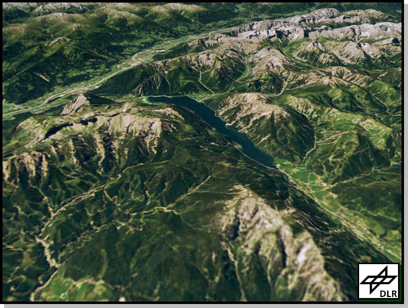
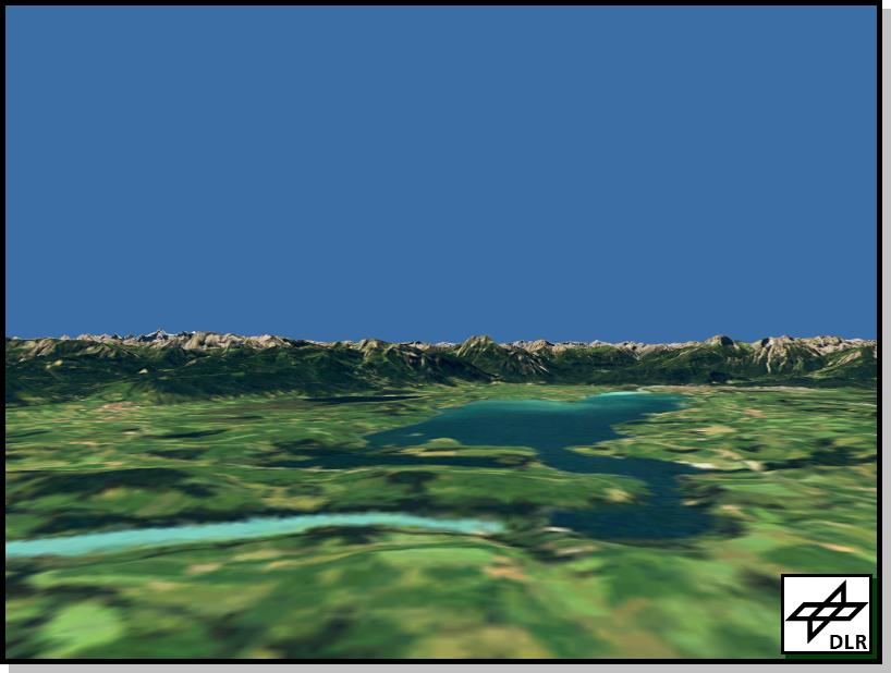
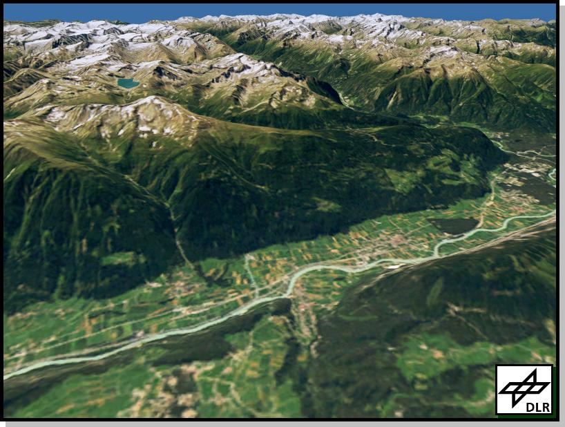
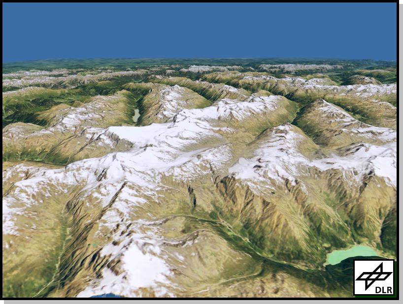
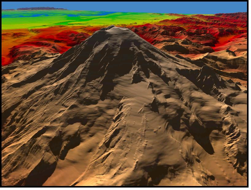
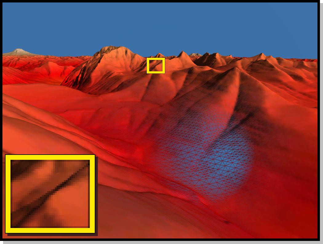
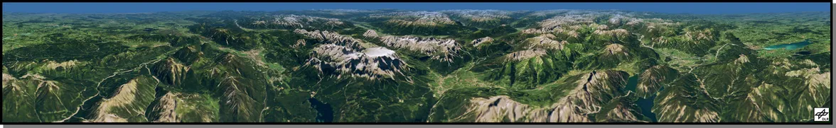
Below are some sample images that have been rendered at framerates of 80-240Hz on a viewport of resolution 1280x1024 using our first prototype. Datasets shown are the Puget Sound region in the state of Washington, USA and the southern part of Bavaria including the Alps and parts of Austria. The Puget Sound data is rastered on a 16K x 16K grid with a spacing of 10m for both geometry and texture. Observe that the texture used is a complete 2D texture and can be exchanged for a phototexture very easily as soon as available. The Alps data set is rastered on a 9Kx9K grid with a spacing of 25m. Here a photo texture of the same resolution is available. Our system was configured to perform Level of Detail rendering of the terrain with a screen space error of just 1 pixel. A larger version of each image can be displayed by clicking on the respective thumbnail.