A System for Visualizing Spatiotemporal Urban Datasets
Stefan Hertel, Matthias Wagner, Rüdiger Westermann
Background
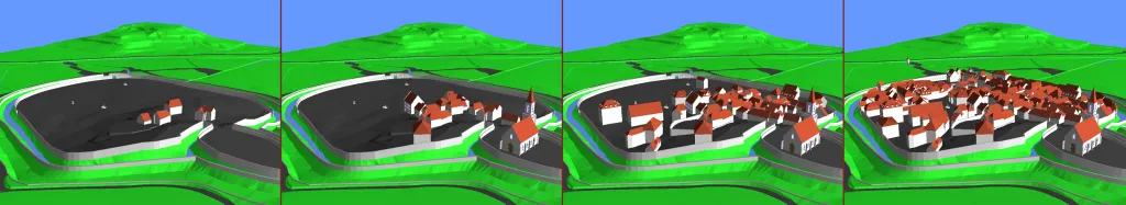
In this paper we present a system for the interactive exploration of large-scale spatiotemporal city models. Our system focuses on interactive techniques that allow the user to navigate freely in space and time, and which can also be used to query particular features of the model. For that purpose we introduce a novel data structure based on a binary space partitioning tree. A four dimensional kD-tree is introduced, which adopts some of the methods that have been used so far for the construction of 3D space partitions. In particular, we extend the SAH method towards its use for partitioning spatiotemporal geometry models. Based on the constructed data structure, our system provides methods to interactively render large-scale city models and to answer spatiotemporal queries. For the visualization we employ rasterization hardware as well as hierarchical occlusion queries that have been adapted to four dimensional models. Spatiotemporal queries are handled by defining a 4D shape and intersecting it with the nodes of the tree. By using a tree-structure as proposed, we will show that large time-varying city models can be explored interactively and at high quality.
Associated publications
A System for Visualizing Spatiotemporal Urban Datasets
S. Hertel, M. Wagner, R. Westermann, Geoinformatics 2009
[Bibtex]